Watch the Birdie
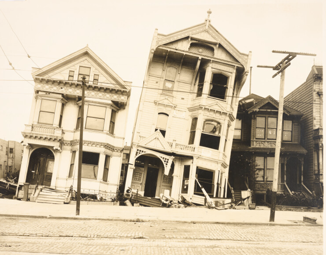
Howard Street (now South Van Ness) between 17th & 18th Streets, 1906
Boom & Bust:
Photographing Northern California
de Young
Ongoing – June 7
In the Bay Area we love our history – our buildings that used-to-be. Privately, I still mourn the iconic Union 76 Clock Tower every time I cross the Bay Bridge. The warmth of our memories of buildings that once-were is a special characteristic of the residents of The Bay. Maybe you think it’s a California-thing. Well, residents of LA don’t drive around their city speaking to their passengers and say: “Remember when the [x] Building was there.” In San Diego and Sacramento, “historic” areas are protected but everything else is up for grabs. Meanwhile, we adjust to the new. (Can anyone really love the Salesforce Tower?) Still, we mourn what was lost.
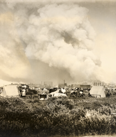

L2R: San Francisco Fire from Camp City at Fort Mason, 1906; On Yerba Buena Anchorage, Men on a Break from Cable Spinning the Bay Bridge, 1935; Misrach, Oakland Fire #12-91, 1991
The de Young offers us a small comfort for this ache. Photographs of Northern California dating back to 1855, more than fifty years before the 1906 earthquake. I’m confident none of you reading this Blog have memories that go back further than that!
THEN & NOW
Ever since a few mineral nuggets were discovered at Sutter’s Mill, Northern California has been considered a land of opportunity – “Gold Mountain” – offering a promise of prosperity that drove westward expansion from the Gold Rush to its present position as the epicenter of technological innovation. San Francisco is the engine of Northern California, for good and bad. The City (and the region) is perennially in a boom-and-bust cycle. Currently, we are lurching from a doom loop (only two years ago) to an AI boom. (As you exit the Bay Bridge into The City EVERY billboard is about who has AI bragging rights.)
CAUGHT IN AMBER
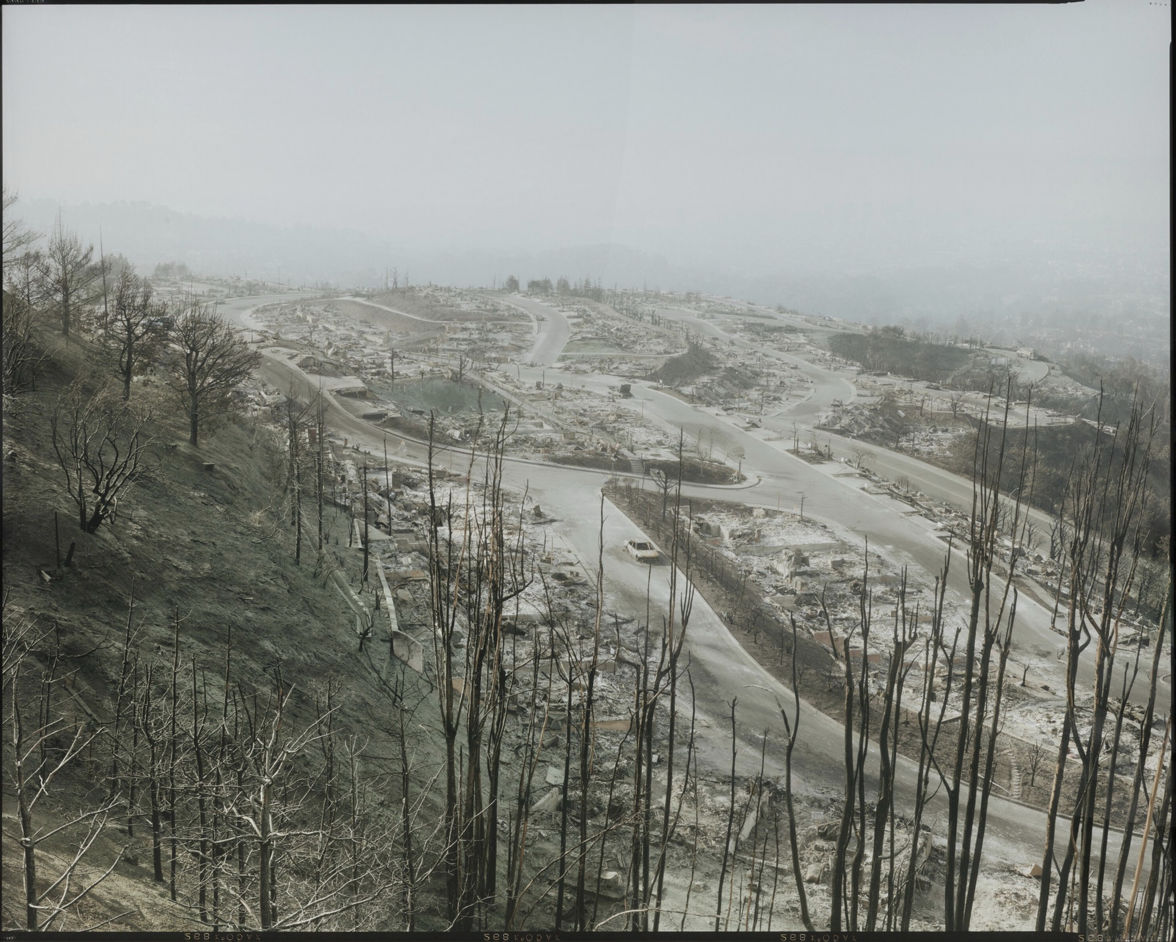
The Gold Rush swept photographers into the area. Their cameras bear witness to the continual construction of the California landscape as well as the destructive environmental forces that threaten its habitability. The photographs in this exhibition chronicle these cycles of urban settlement, including the building and renewal of San Francisco before and after the 1906 earthquake and fire, the construction of the Golden Gate Bridge and Bay Bridge and the development of San Francisco’s South of Market neighborhood. Above all, the works confirm how periods of growth and decline have always been part of the story of Northern California and attest to the continued resilience of this land and its inhabitants.
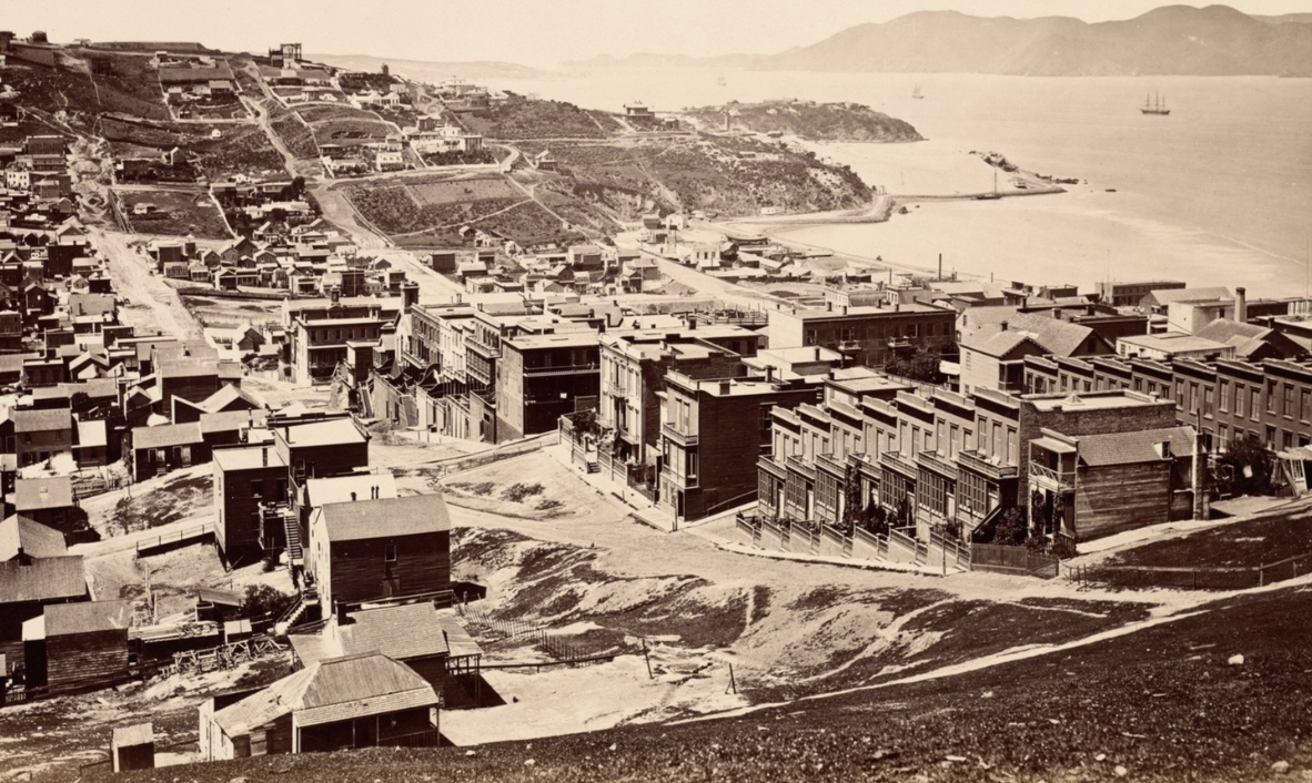
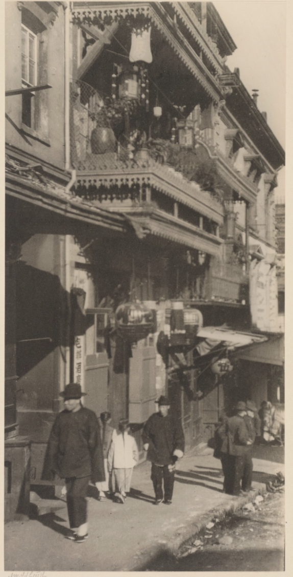
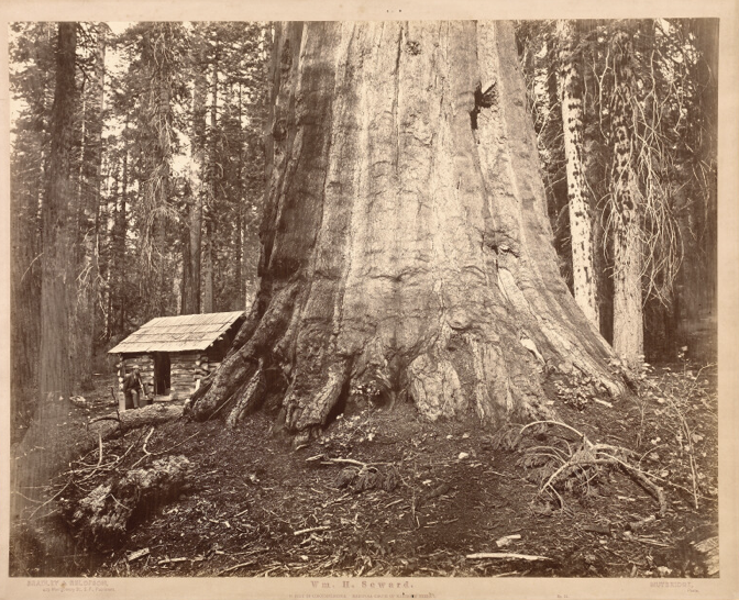
L2R: Watkins, View from Telegraph Hill, 1868; Genthe, The Street of Painted Balconies 1896; Muybridge, Wm. H. Steward, 85 feet in circumference, in the Mariposa Grove of Mammoth Trees, 1872 (When did we stop giving trees names? Maybe we should reinstate that tradition.)
The show also depicts how good economic times come at a cost. During the Gold Rush, Native tribes were being murdered or run off their ancestral lands. As the timber industry was getting rich off California’s redwoods, the felling of trees permanently burdened the environment. While the dot-com bubble gussied up SOMA, the people, many of them artists, who had called the area home were priced out.
TAKEAWAY
When you view the exhibition, take some of your 20- and 30-somethings along with you. Regale them with stories of what used to be. Sure, they’ll be checking their phones looking for any reason to pull away, even for a few minutes. Still, warm yourself with the knowledge that, in 2056, they will be the ones dragging their own broods around the de Young photo exhibit that year, talking about “what was.” If the Bay Area is in their bones, these aging Millennials and Gen Zers will remember, feel that ache and probably smile when they reflect on the special continuum unique to The Bay.
My thanks to Sam Mondros, The San Francisco Standard
For more information on this exhibition, click here.